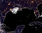
Coastal resilience engineering faces an immediate stress test as Tropical Storm Edouard tracks toward the northwestern Gulf Coast. Systems operating under standard meteorological reporting treat such events as isolated weather anomalies. This approach fails because it ignores the mechanical interaction between slow-moving atmospheric vortices, bathymetric shelf profiles, and regional drainage capacities. Managing storm impacts requires viewing landfalling low-pressure systems through a framework of fluid dynamics, hydrological thresholds, and infrastructural capacity constraints.
The Kinematics of System Intensification
Tropical Storm Edouard formed over the Gulf of Mexico with maximum sustained winds hovering near the baseline threshold of 39 to 40 miles per hour. Velocity alone, however, offers a misleading metric for structural risk. The primary hazard driver resides in translational speed paired with thermal energy absorption from surface waters.
Operating at a forward translation rate of roughly 6 to 8 miles per hour, the system spends an extended duration over specific geographic coordinates. This slow translation rate alters the total volumetric water delivery per square mile.
- Thermal Fuel Efficiency: Sea surface temperatures across the northwestern Gulf provide continuous latent heat flux, feeding the core convective engine.
- Shear Environment: Low vertical wind shear allows upright vertical tower development, concentrating rainfall production bands near the immediate coast.
- Frictional Convergence: Landfall transition introduces surface friction asymmetry, forcing low-level wind vectors to decelerate and converge, which accelerates vertical mass uplift and intensifies localized precipitation rates.
The Hydrological Cost Function of Inundation
Precipitation forecasts for the upper Texas coast and southwest Louisiana project baseline accumulations of 3 to 6 inches, with isolated ceilings reaching 9 inches. The economic and structural cost of these volumes depends on regional hydrological absorption capacities.
Urbanized coastal sectors feature high ratios of impermeable surface cover. Concrete and asphalt infrastructure completely bypasses normal soil infiltration rates, shifting the burden entirely to engineered drainage networks, culverts, and bayou discharge channels.
When rainfall intensity surpasses the discharge design limits of these channels, surface storage capacity drops to zero. Water accumulates in low-lying topographies, creating localized retention basins that remain stagnant until gravity drainage catches up with the inflow volume. Rural zones experience a different failure mode, where saturated soils reject further moisture, transforming sheet flow across agricultural fields into rapid creek and riverine escalation.
The Mechanics of Coastal Storm Surge
Beyond direct precipitation, the marine boundary layer responds to atmospheric pressure drops and wind stress vectors. Tropical Storm Edouard triggers a storm surge watch spanning from upper Texas boundaries into southwestern Louisiana, with projected water height anomalies reaching 2 to 4 feet above normal ground level, and localized extremes up to 5 feet depending on astronomical tide phases.
Storm surge generation relies on two distinct physical mechanisms:
- Inverted Barometer Effect: Lower atmospheric pressure at the eye of the storm reduces downward force on the ocean surface, allowing local sea level to rise beneath the core.
- Wind-Driven Ekman Transport: Persistent onshore winds drag surface water masses forward, piling liquid volume against the continental shelf where shallow bathymetry prevents the water from dispersing downward.
When peak marine push coincides with high astronomical tide cycles, coastal barriers experience simultaneous hydraulic pressure from both the seaward and landward sides. This dual-vector loading explains why severe structural damage frequently occurs well outside the primary wind damage swath.
Operational Allocation and Mitigation Priorities
Emergency management frameworks must shift from reactive evacuation management to resource prepositioning based on quantitative risk mapping. Infrastructure operators in high-risk zones should execute three immediate operational steps to mitigate asset failure:
- De-energize Vulnerable Sub-Stations: Isolate low-lying electrical nodes before rising saline water causes permanent short-circuit degradation to transformers.
- Clear Primary Drainage Throttle Points: Remove vegetative debris and urban refuse from storm grate intakes to maximize gravity-fed runoff velocity before peak rainfall bands arrive.
- Secure Mobile Marine Assets: Relocate commercial and municipal watercraft away from low-elevation docks where shifting storm surge water levels can snap moorings against pylons.
Position heavy dewatering pumps at known topographic depression points before road networks become impassable due to rising sheet water. Treat the approaching landfall not as a temporary weather event, but as a temporary, high-volume hydraulic saturation test of regional civil engineering.
This video provides a meteorological breakdown of Tropical Storm Edouard's path and intensity as it targets the Texas and Louisiana coastline.
http://googleusercontent.com/youtube_content/1