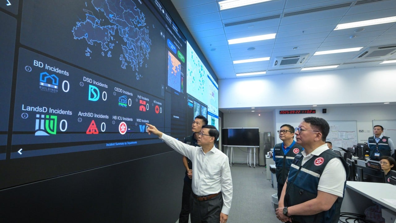
Modern metropolitan governance faces an acute operational bottleneck. As population density increases alongside climate volatility, traditional municipal management structures—characterized by siloed department databases and reactive human dispatch—fail to process urban telemetry at the speed of failure. When municipal systems rely on manual aggregation during extreme weather events or structural failures, latency directly scales casualties and economic downtime.
To resolve this latency gap, municipal authorities increasingly turn to centralized computational layers designed to ingest multi-source sensor inputs and optimize emergency resource allocation. The structural deployment of Hong Kong's administrative initiative for an integrated computational framework, colloquially termed an urban intelligence matrix or city brain, highlights the transition from fragmented departmental computing to unified operational feedback loops. Evaluating the functional mechanics of this architectural shift requires examining the data pipelines, the structural constraints of cross-departmental integration, and the exact failure modes inherent in large-scale municipal automation.
The Data Ingestion Layer and Telemetry Convergence
The primary engineering challenge of any municipal intelligence system is overcoming data fragmentation. In a standard metropolitan administration, distinct entities—such as transit networks, public works, meteorological stations, and citizen grievance hotlines like the 1823 contact center infrastructure—operate independent data warehouses. These silos utilize disparate schemas, non-standardized communication protocols, and asynchronous update cycles.
An effective urban operating system must establish a unified ingestion fabric. This requires three distinct functional stages:
- Protocol Normalization: Converting raw sensor streams, video feeds, structural health monitors, and text logs from the public hotline into a standardized schema format at the edge or ingestion gateway.
- Spatial-Temporal Indexing: Assigning every data point a precise geographic coordinate and a high-resolution timestamp to ensure spatial correlation between disparate events, such as linking a sudden spike in drainage-system water levels with local topographical traffic telemetry.
- State Estimation: Running continuous streaming analytics to maintain a real-time mathematical representation of the city's current operational state, filtering out sensor noise and transient anomalies.
Without this normalization layer, machine learning models cannot accurately parse inputs. The administrative plan to connect emergency service databases and citizen contact infrastructure by the third quarter of 2028 addresses this exact structural isolation. By forcing disparate legacy systems to interface through a common integration bus, the architecture replaces human-mediated phone calls and manual data entry with programmatic data exchange.
The Optimization Engine and Resource Allocation Logic
Once telemetry data is normalized and ingested, the intelligence matrix shifts from descriptive monitoring to prescriptive optimization. In disaster response scenarios—such as severe typhoons or localized flash floods—the core economic and operational variable is dispatch latency.
The mathematical function governing emergency response can be expressed as minimizing total system loss, where total loss is a function of incident detection time, routing delay, and resource contention:
$Loss = f(T_{detect}) + g(T_{route}) + h(Resource_Contention)$
Traditional governance minimizes these variables through human heuristics, dispatcher experience, and fixed response protocols. An integrated computational framework targets each variable programmatically:
- Detection Acceleration: Computer vision models analyzing closed-circuit telemetry can identify blocked roadways, rising water levels, or structural anomalies seconds after occurrence, bypassing the delay inherent in waiting for citizens to report incidents via hotlines.
- Dynamic Routing: Rather than dispatching emergency vehicles via static jurisdictional boundaries, predictive algorithms calculate optimal paths based on real-time traffic density, weather impacts, and historical bottleneck probabilities.
- Resource Balancing: During multi-incident crises, optimization algorithms compute global utility functions to allocate finite emergency units (ambulances, pumps, rescue crews) to locations where marginal utility is maximized, preventing localized over-allocation.
Despite these efficiencies, automated allocation introduces systemic risk. If training data underrepresents specific micro-neighborhoods or edge-case topographies, optimization algorithms can systematically under-allocate resources to marginalized zones, introducing algorithmic bias into public safety operations.
Operational Scope Boundaries and Privacy Architecture
A critical tension in municipal AI deployment centers on the boundary between operational efficiency and civil liberties. Broad deployments of surveillance and data-aggregation tools frequently trigger valid concerns regarding continuous tracking and mass profiling.
To maintain institutional legitimacy, administrative frameworks must enforce strict architectural boundaries:
- Functional Segregation: The system must be explicitly hard-coded or architecturally partitioned to reject law enforcement or criminal identification modules. When administrative leadership explicitly designates the system for municipal management rather than criminal investigation, this boundary must be verifiable via open-source software audits and verifiable data access logs.
- PII Minimization: Telemetry pipelines must execute automated anonymization at the edge. Video streams utilized for traffic flow analysis or crowd density estimation during typhoons should process only vectorized metadata or low-resolution optical flow without retaining identifiable facial geometry or persistent individual tracking identifiers.
- Access Auditing: Cross-departmental data sharing creates lateral privacy vulnerabilities. Strict role-based access control must govern which operational units can query historical datasets, preventing mission creep where infrastructure data is repurposed for surveillance applications.
Failing to build these constraints directly into the system architecture generates public friction, undermines user trust, and can result in legal challenges that stall deployment phases.
Systematic Stress Testing and Validation Protocols
Moving from conceptual design to operational reality requires iterative validation. Municipal environments are complex adaptive systems characterized by non-linear responses; a minor adjustment in traffic light timing can induce cascading gridlock three districts away. Therefore, pre-deployment testing cannot rely on dry-run simulations alone.
The empirical approach requires a multi-stage validation pipeline:
- Component-Level Stress Tests: Isolating individual machine learning models and data pipelines to evaluate performance under degraded network conditions, such as simulated packet loss or intermittent Wi-Fi connectivity at public transport interchanges.
- Integration Drills: Executing controlled end-to-end simulations during non-crisis windows, routing simulated emergency signals from contact centers through the central integration bus to measure end-to-end latency and human operator comprehension of system outputs.
- Phased Expansion: Deploying the architecture within bounded geographical sub-sectors or single-hazard domains (such as specific flood-prone drainage basins) before scaling to city-wide operations.
The execution of numerous system trials and field drills prior to full deployment windows represents the necessary empirical groundwork required to discover edge cases—such as slippery infrastructure surfaces or sensor blind spots—that theoretical planning inevitably misses.
Establish a rigorous, independent technical audit committee comprising software engineers, data privacy specialists, and urban planners with mandate power to inspect data schemas, verify the absence of unauthorized surveillance modules, and continuously benchmark system latency against historical non-automated baselines.